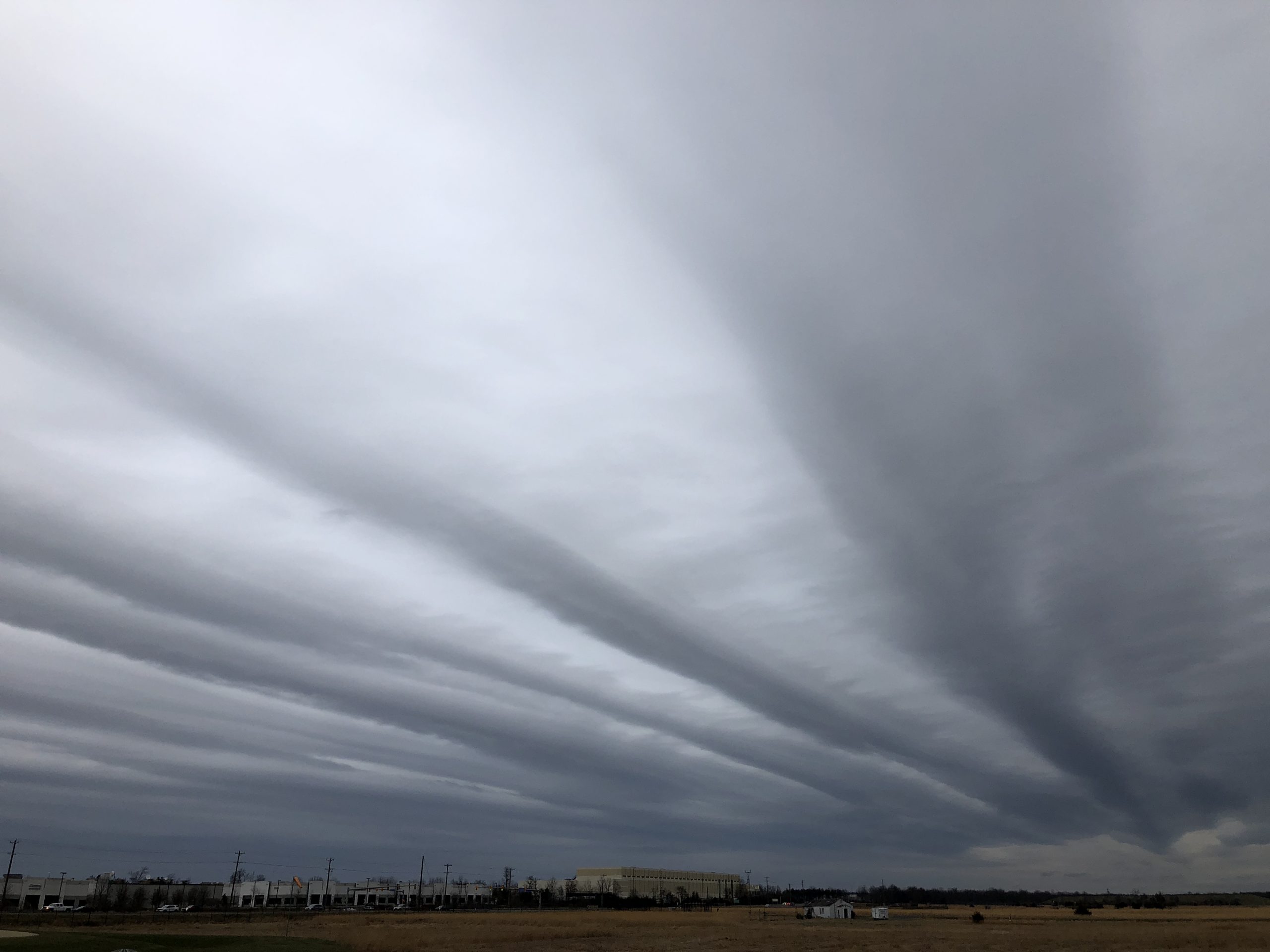
What are the formation and features of altostratus clouds

The study of clouds is integral to understanding weather patterns and forecasting. Among the various cloud types, **altostratus clouds** hold a significant position due to their unique formation, appearance, and the weather phenomena they indicate. These clouds, falling under the stratiform category, serve as a visual representation of the atmospheric conditions at play, providing insight into impending weather changes.
**Altostratus** clouds are typically found in the middle layers of the atmosphere, characterized by their uniform gray or blue-gray color. The study of altostratus clouds offers fascinating insights into meteorological processes and the dynamics of weather systems. In this article, we will delve into the formation and features of altostratus clouds, exploring their characteristics, differentiation from other cloud types, and the weather conditions they signify.
What Are Altostratus Clouds?
**Altostratus clouds** are a type of mid-level cloud typically forming between 6,500 and 23,000 feet. Falling under the category of stratiform clouds, they are known for their extensive horizontal coverage, often enveloping the sky in a thick layer. Altostratus clouds usually appear as gray or blue-gray and can obscure the sun, creating a diffused light effect. Unlike other cloud types, altostratus does not exhibit a fluffy structure; instead, they give a smooth and even layer that signals significant atmospheric moisture.
These clouds are primarily composed of water droplets but can also consist of ice crystals when temperatures drop at higher altitudes. As a result, altostratus clouds play a crucial role in the overall weather system, particularly in leading to precipitation in the form of rain or snow. Understanding these clouds is vital, as they can indicate changes in weather that affect daily life and safety.
Formation of Altostratus Clouds
The formation of **altostratus** clouds is an interesting meteorological process. They typically form under specific conditions, primarily influenced by the movement of air masses. When warm and moist air rises, it cools and condenses at higher altitudes, resulting in the formation of **altostratus clouds**. This process often occurs when a warm front approaches a region, causing the moist air to be lifted over colder air. As the rising air cools, the moisture present condenses, creating the **altostratus cloud** layer.
Another factor contributing to the development of altostratus is atmospheric instability. When air is warmed at the surface but cools rapidly with altitude, this unstable environment can lead to the vertical development of clouds, resulting in altostratus formations. This process can also be influenced by geographic features such as mountains, where orographic lift causes the air to rise and cool, forming the characteristic layer of these clouds in the sky.
Characteristics of Altostratus Clouds
**Altostratus clouds** are distinct from other cloud types in several ways. One of their primary characteristics is their **uniformity**, creating a smooth blanket that covers the sky without the varied formations seen in cumulus clouds. They are generally light to medium gray in color and are mostly uniform, although they can exhibit variations in shade. This consistency in color and form makes them easily identifiable among other cloud types.
In terms of thickness, **altostratus** clouds are typically thicker than cirrostratus but thinner than nimbostratus. This thickness can influence how much sunlight penetrates through, often creating a soft, muted light below. **Altostratus cloud** formations can sometimes lead to light precipitation, either in the form of rain or snow, especially at the edges where they may thicken and transition into nimbostratus.
Altostratus vs. Other Cloud Types
To appreciate the uniqueness of **altostratus**, it is essential to compare them to other cloud types. For instance, while **nimbostratus clouds** typically produce consistent, continuous precipitation, altostratus clouds may indicate the onset of such weather but do not produce significant rainfall by themselves. In contrast, cumulus clouds are more puffy and often associated with fair weather, while **cirrostratus**, found at higher altitudes, are thin and often precede a warm front.
Moreover, **altostratus clouds** can often be confused with stratus clouds, which are also uniform but generally form at lower altitudes. The key difference is that altostratus are often higher and typically indicate more significant moisture in the upper atmosphere, whereas stratus clouds may produce light drizzle or mist but lack the thickness and moisture content of altostratus.
Weather Associated with Altostratus Clouds
The presence of **altostratus clouds** often signals that a shift in weather is on the horizon. While they may not bring immediate precipitation, they typically occur when a warm front approaches, suggesting that rain is likely to follow within the next 24 hours. **Altostratus** clouds serve as precursors to larger storm systems and can be part of the broader dynamic of weather patterns, indicating increased atmospheric moisture and instability.
When **altostratus clouds** develop, observers can expect to see an overall increase in cloud cover with the potential for light precipitation. If the altostratus clouds thicken further, they may evolve into nimbostratus, resulting in steady rainfall or snow. It's crucial for meteorologists to monitor altostratus formations as they can provide valuable clues about the approaching weather system.
Conclusion
**altostratus clouds** are a significant component of the atmospheric landscape, providing essential insight into weather prediction and climate dynamics. Their formation through the rising and cooling of moist air illustrates the intricacies of meteorological processes. Understanding **altostratus** clouds and their characteristics not only enhances our knowledge of cloud types but also aids in anticipating weather changes.
By distinguishing altostratus from other cloud forms, we can gain a greater appreciation for their role in the atmosphere. As weather patterns continue to evolve, the study of clouds, especially **altostratus**, remains vital for enhancing our forecasting abilities and understanding our environment better.
Did you find this article helpful? What are the formation and features of altostratus clouds See more here Education.
Leave a Reply


Related posts